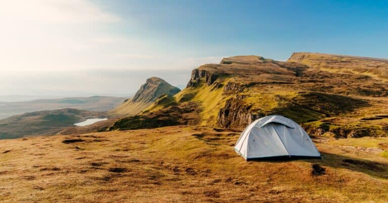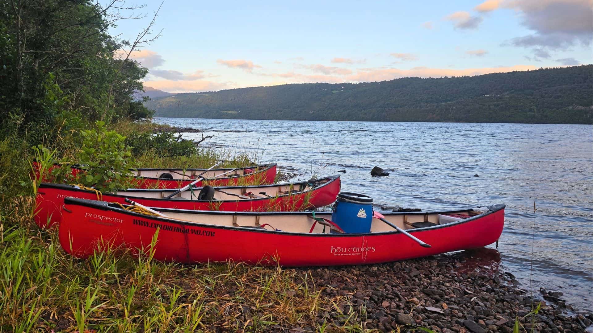
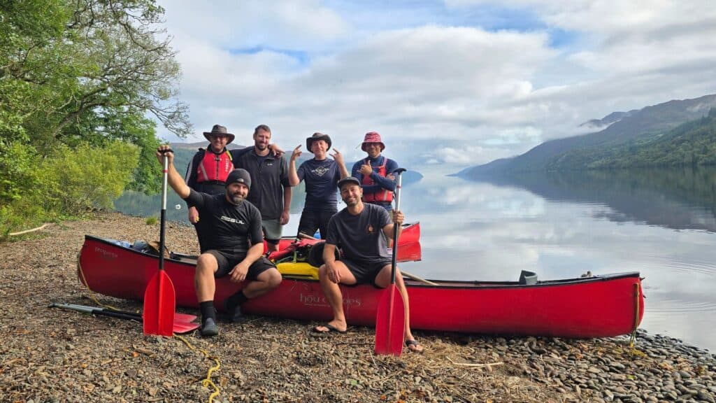
At the end of August, six of us set off from Neptune’s Staircase in Fort William with three hired canoes and a plan to paddle 95km (60 miles) to Inverness in five days.
The Great Glen Canoe Trail is Scotland’s first official canoe trail. It follows the Caledonian Canal and links Loch Lochy, Loch Oich and Loch Ness across the Highlands, coast to coast. It’s one of the best multi-day paddles in the UK, but it’s harder than it looks on the map.
This guide covers everything I wish I’d known before we went: registering, hiring a canoe, where to camp, how the portages work, and what Loch Ness is really like in a canoe. If you want to know what I packed, my Great Glen Canoe Trail kit list covers it item by item.
Thanks for your support – I may earn a small commission from affiliate links in this article Learn more
Great Glen Canoe Trail: Quick Facts
- Distance: 95km (60 miles)
- Start/finish: Fort William (Corpach/Banavie) to Inverness
- Time needed: 3–5 days (5 recommended; we did it in 4)
- Best direction: West to east, with the prevailing wind behind you
- Water: About 35km (22 miles) of canal, the rest open loch: Lochy, Oich, Ness and Dochfour
- Portages: 9 on the official route, around the canal locks
- Registration: Free, online with Scottish Canals
- Facilities key: £10, gives access to toilets, showers and composting toilets along the canal
- Camping: Trailblazer Rests, informal sites, campsites and wild camping
- Season: Late March to late September
- Difficulty: Moderate to hard – open-water experience recommended
- Suitable for: Open canoe, kayak, experienced paddle boarders
- Maps and guidebook: Harvey Great Glen Way map and Donald MacPherson’s Great Glen Canoe Trail guidebook
Download the official map: Scottish Canals publish a free Great Glen Canoe Trail map and guide (PDF) with every portage, campsite, Trailblazer Rest and access point marked. Download it before you go, as phone signal is patchy along the lochs.

What Is the Great Glen Canoe Trail?
The Great Glen Canoe Trail is a 95km (60 mile) paddling route from Fort William on the west coast to Inverness on the east, following the Caledonian Canal. It launched in 2012 as Scotland’s first long-distance canoe trail.
Only about 35km (22 miles) is man-made canal. The rest is open water across four lochs: Loch Lochy, Loch Oich, Loch Ness and the small Loch Dochfour at the northern end. The canal sections are calm and sheltered, while the lochs can turn rough very quickly.
The canal itself was designed by Thomas Telford and opened in 1822, after almost 20 years of work and nearly double its original budget. It was built to give ships a safer route between the east and west coasts, avoiding the storms around the north of Scotland, and to create work in the Highlands after the Clearances. Today it’s used almost entirely by cruisers, yachts and paddlers.
Is the Great Glen Canoe Trail Right for You?
If you have some open-water paddling experience and a reasonable level of fitness, yes. Scottish Canals recommend that paddlers have experience of long-distance or open-water canoeing before tackling the lochs, and having done it, I agree.
Loch Lochy and Loch Ness are both classed as Class C waters. The water is cold all year, and waves on Loch Ness have been recorded as high as 3m (9ft) in strong winds.
I’ve paddled a lot, mostly on a paddle board, and I’d done multi-day canoe trips before on the River Wye. The rest of our group had fairly limited experience, and I think most of them underestimated the effort. On waterways like the Wye, the current does a lot of the work for you. On the Great Glen, there’s no current to help. Every kilometre comes down to your arms, unless the wind is behind you and you can get a sail up.
Can Beginners Do the Great Glen Canoe Trail?
Complete beginners shouldn’t take it on unguided. If you’re new to canoeing but keen, a guided trip is the way to do it. Companies like Explore Highland run guided trips of two to five days, although even their guided trips expect some tandem canoe experience.
Can You Do It on a Paddle Board or in a Kayak?
Yes, but a canoe is the easiest option. A canoe carries far more kit, and it’s more stable when Loch Ness gets choppy. We saw one kayaker crossing the lochs during our week, and kayakers often finish in about three days. We didn’t see a single paddle boarder.
If you want to paddle board the Great Glen, you’ll need at least a touring board, such as the Bluefin Carbon or the Red Paddle Co Voyager, a 401cm (13’2″) touring board with bungee tie-downs at both ends for carrying kit, plus solid open-water experience and backup plans for days when the lochs aren’t safe.
Planning Your Trip
Registering for the Great Glen Canoe Trail
Before you go, register your trip with Scottish Canals. It’s free and takes a couple of minutes through the online form on the Scottish Canals Great Glen Canoe Trail page. Registration lets them know who’s on the water and when, which matters if anything goes wrong on the lochs.
Don’t expect a confirmation email. Scottish Canals don’t currently send one, so screenshot the form once you’ve submitted it.
Is the Facilities Key Worth It?
Yes. Alongside registering, you can buy a facilities key that opens the toilets, showers and laundry along the canal, plus the composting toilets at the Trailblazer Rests. It costs £10. You can pick one up and pay in person at the Scottish Canals offices at Corpach Sea Lock or Inverness, or arrange it in advance by phone on 01463 725500. Postage adds to the cost, so collecting it is the cheaper option.
We bought one key and shared it between the six of us. After a long day on the water, a hot shower made a huge difference, and it was easily the best money we spent on the trip.
Which Direction Should You Paddle?
West to east, from Fort William to Inverness. The prevailing wind in the Great Glen is south-westerly, so paddling this way usually puts it behind you, which is why almost every guide and outfitter recommends it.
It’s not guaranteed, though. If the forecast shows a strong north-easterly for your week, you can paddle the trail in reverse, from Inverness to Fort William.
How Long Does the Great Glen Canoe Trail Take?
Most people take three to five days. Scottish Canals suggest five days by canoe, and kayakers often do it in three. We planned for five and finished in four after a gale warning forced us to speed up.
The official five-day plan looks like this:
- Day 1: Fort William to Gairlochy – 10.5km
- Day 2: Gairlochy to Loch Oich – 22km
- Day 3: Loch Oich to Foyers – 26.5km
- Day 4: Foyers to Dochgarroch – 23.5km
- Day 5: Dochgarroch to Inverness – 8km
Our four days ran like this:
- Day 1: Neptune’s Staircase to Loch Lochy – camped at the Loch Lochy Trailblazer Rest
- Day 2: Loch Lochy to Fort Augustus, via Loch Oich – wild camped on Loch Ness, just past Fort Augustus
- Day 3: Fort Augustus along Loch Ness – wild camped on a beach across the loch from Urquhart Castle
- Day 4: Urquhart Castle to Inverness – finish
Build a spare day into your plans if you can. Wind can shut Loch Ness for a day at a time, and having the extra day takes the pressure off.

When Is the Best Time to Paddle the Great Glen?
The season runs from late March to late September. Most people paddle between late spring and early autumn, when the days are longer and the water is a little warmer.
We went in the last week of August, running into early September, which is towards the end of the main season. The big advantage was how quiet it was. All week, we passed one group coming the other way and shared the route with one other group heading in our direction.
Getting There and Back
Fort William and Inverness are both easy to reach. You can drive, take the train to either town, or fly into Inverness. The tricky part is that you finish 95km from where you started, so you’ll need a shuttle or a plan to get back to your car.
We drove up and met our canoe hire company at the finish in Inverness on the Sunday evening. They drove us and the canoes down to Fort William, where we camped the first night, then met us in Inverness at the end of the trip to collect the canoes.
Hiring a Canoe vs Bringing Your Own
Unless you own a tandem canoe and a way to get it to Scotland, hiring makes the logistics far simpler. We hired through Explore Highland, and Donald handled the drop-off and collection.
It cost £280 per canoe, so £140 each between two of us. Each canoe came with:
- Three paddles
- Buoyancy aids
- A waterproof barrel
- A baler and sponge
- A sail
- A portage trolley
- Straps
Across the group, we were also given a large water container, a lock and a toiletry bag.
Maps and Guidebooks
Alongside the free Scottish Canals map, two resources made a big difference to our trip.
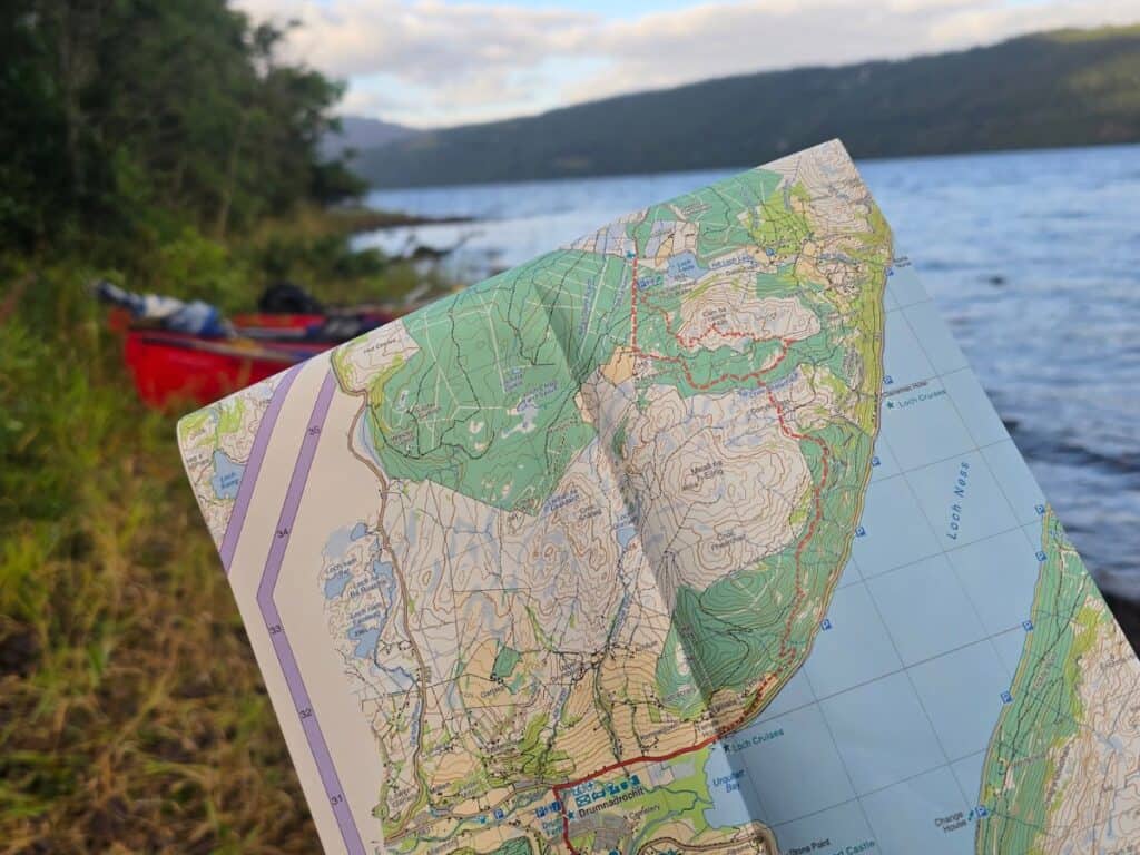
Harvey Great Glen Way map: We used Harvey’s Great Glen Way map for navigation. It’s a 1:40,000 strip map covering Fort William to Inverness, and it’s fully waterproof, which is obviously useful when it ends up sitting in the bottom of a canoe. It’s designed for the walking route, but the Great Glen Way follows the canal and lochs closely, so it works well from the water too.
Great Glen Canoe Trail guidebook: Great Glen Canoe Trail by Donald MacPherson (Pesda Press, second edition 2020) was a great resource before and during the trip. Donald was the project officer who helped set up the trail, working with landowners, lock keepers and contractors. He also runs Explore Highland, who we hired our canoes from. The book covers the five-day route, alternatives, safety and kit, and it’s the most detailed guide to the trail you’ll find.
The Great Glen Canoe Trail Stage by Stage
This is the official five-day breakdown recommended by Scottish Canals, with a few notes from our own trip along the way.
Day 1: Fort William to Gairlochy
Distance: 10.5km ·
Water: Canal
Portages: 2 (Neptune’s Staircase and Gairlochy)
Camp: Gairlochy
Most paddlers start at Corpach or at the top of Neptune’s Staircase in Banavie. The staircase is the longest in Britain: Telford’s flight of eight locks lifts boats 20m (64ft) in under 500m, and it’s worth a wander up and down before you set off.
The first stretch follows the canal north-east to Gairlochy. It’s calm and sheltered, and a good chance to get used to the canoe and work out who’s steering. This first stretch took us about two hours.
The official plan has you camping at Gairlochy on the first night. If you start early, you’ll get there well before lunch, so it’s worth pushing on to Loch Lochy.
Portage tip: throughout the trip, portage out on the left-hand side every time, except the final portage at Inverness, which is on the right.
On our trip: We reached Gairlochy by late morning, so we carried on to the Loch Lochy Trailblazer Rest.
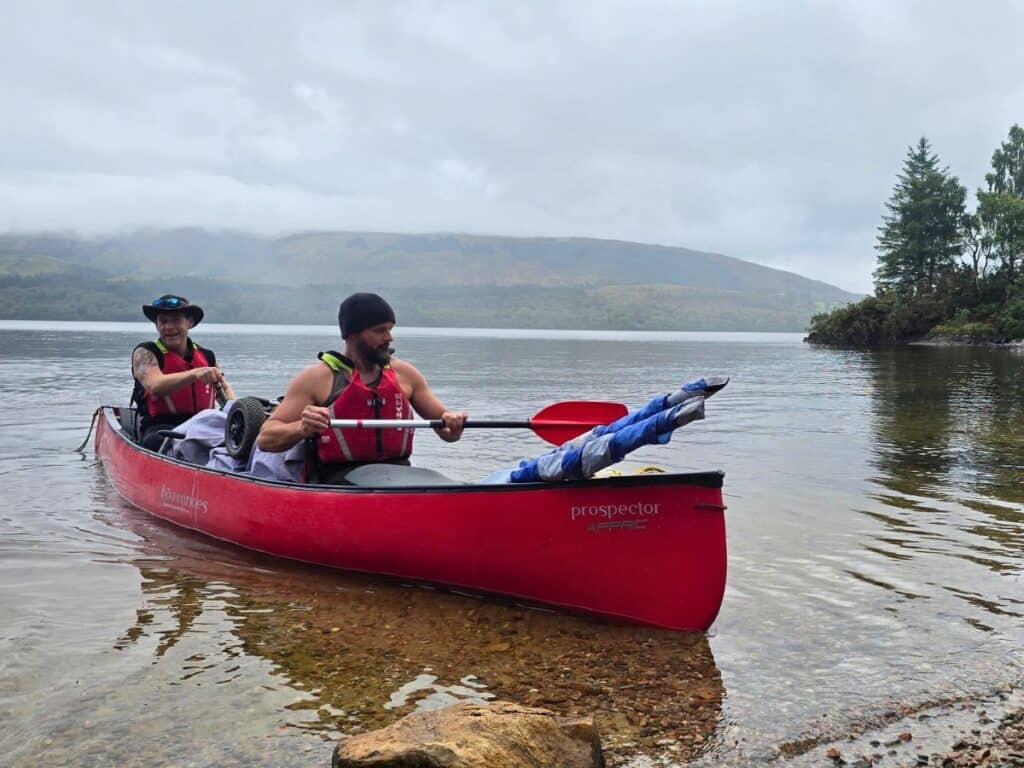
Day 2: Gairlochy to Loch Oich
Distance: 22km
Water: Loch Lochy, canal and Loch Oich
Portages: 1 (Laggan Locks)
Camp: Leiterfearn Trailblazer Rest
Loch Lochy is the first open water of the trail, and for a lot of paddlers it’s the first real test. From the lock at Gairlochy, either follow the edge of the north shore or take a diagonal line from the south-western corner towards Clunes to reach the north shore, then follow the shore up the loch. Expect the crossing to take around two hours.
On the official plan, you’ll paddle past the Loch Lochy Trailblazer Rest. It’s worth knowing about if you push on further on day one. The original site at Glas Dhoire can still be used, but a large construction project there means the camp has moved a little further west, so you’ll reach the Trailblazer site slightly sooner than older guides and maps suggest. Look for a beach with a carved wooden canoe with three bears sitting in it. It has a long beach, a wooden hut behind the trees, a large fire pit surrounded by benches, plenty of places to pitch, and a composting toilet.
At the north-eastern end, don’t hug the shore and then cut straight across to the exit. Waves running down the loch will hit you side-on. Take a diagonal line across the end of the loch instead, so they stay behind you.
Just around the corner is the portage at Laggan Locks, then a short stretch of canal opens straight onto Loch Oich, the smallest loch on the route and the highest point of the trail. From here, every lock takes you downhill towards Inverness. The day ends at the Leiterfearn Trailblazer Rest on the shore of Loch Oich.
On our trip: Because we’d gone further on day one, we camped at the Loch Lochy Trailblazer Rest rather than Leiterfearn. The weather closed in halfway across the loch, and cloud hid the mountains on the far shore. The next morning, a few of our canoes took on so much water at the end of the loch that they had to land and bail out. Loch Lochy was also where I first used the sail, and it ended up being my favourite loch of the trip.

Day 3: Loch Oich to Foyers
Distance: 26.5km
Water: Loch Oich, canal and Loch Ness
Portages: 3 (Cullochy Lock, Kytra Lock and the Fort Augustus lock flight)
Camp: Loch Ness Shores campsite, near Foyers
The day starts by crossing the rest of Loch Oich, then follows the canal through Cullochy and Kytra Locks towards Fort Augustus.
The biggest portage of the trail is at Fort Augustus, where the canal drops through a flight of five locks in the middle of the village. It’s a carry of around 500m: down the left-hand side of the locks, across the main road, and down to Loch Ness.
Fort Augustus is the best place on the trail to resupply. There are shops, pubs and a chippy, and it’s the obvious place to stock up on water before Loch Ness.
From Fort Augustus, you’re onto Loch Ness. It’s more than 32km (20 miles) long and completely exposed to the wind running down the glen. It’s the longest and most serious section of the trail, so read the section on paddling Loch Ness safely below before you set off.
We stayed on the south shore, which is the safer side to paddle. The north shore runs alongside the A82 and has fewer places to land.
Conditions change fast. Our day on Loch Ness started like a millpond and turned into 80cm (2.5ft) waves into a headwind within a few hours. Plan short stints, take breaks on the beaches, and check the forecast every morning. The official day ends at Loch Ness Shores campsite near Foyers, which also has a Trailblazer Rest.
On our trip: We covered Loch Lochy, Loch Oich and Fort Augustus in one long day, with four portages, then wild camped in woodland just past Fort Augustus. Turn right across the mouth of the canal and paddle a little further along the shore to find a spot. We celebrated with fish and chips in town.

Day 4: Foyers to Dochgarroch
Distance: 23.5km
Water: Loch Ness and Loch Dochfour
Portages: 1 (Dochgarroch Lock)
Camp: Dochgarroch Lower
The second half of Loch Ness takes you past Urquhart Castle on the north shore, one of the most photographed ruins in Scotland. It changed hands several times during the Wars of Scottish Independence, and government troops blew up its gatehouse in 1692 so the Jacobites couldn’t use it. It’s been a ruin ever since.
At the north-eastern end, cross the end of the loch diagonally, as on Loch Lochy. A heavily loaded canoe sits low and takes on water easily in following waves, so pack as light as you can. You’ll pass Bona Lighthouse, one of the only inland lighthouses in Britain, on the way out of the loch.
From there, you pass through little Loch Dochfour to Dochgarroch Lock, where you rejoin the Caledonian Canal and portage for the night.
On our trip: A gale warning meant we paddled all of Loch Ness in a day and a half, including almost eight hours into a headwind. We spotted an egret nest near Foyers and wild camped on a beach across the loch from Urquhart Castle, then paddled all the way to Inverness the next day.

Day 5: Dochgarroch to Inverness
Distance: 8km
Water: Canal
Portages: 2 (Torvean and Tomnahurich)
Finish: Muirtown car park
The final stretch follows the Caledonian Canal into Inverness, with portages at Torvean and the Tomnahurich swing bridge. Remember, the last portage is the only one you take out on the right-hand side. The official finish is at Muirtown car park.
On our trip: We took the canoes out at Tomnahurich and finished at the car park by the Jammy Piece café, where we’d left our cars, and waited for Donald to collect the canoes.
For the full story of our four days, read my Great Glen Canoe Trail trip report.

How Do the Portages Work?
There are 29 locks on the Caledonian Canal, and paddlers aren’t allowed through them, so you carry your canoe around instead. Many sit together in flights, like Neptune’s Staircase and Fort Augustus, so the number of actual portages is much lower. Most carries are around 200m, while Fort Augustus is closer to 500m. On the official route, there are nine portages in total.
Portaging became a fine art for us. By the end, Adam and I had it down to about 10 minutes: unload the heavy kit, carry or wheel the canoe round, reload and go. Most of the group took a more leisurely pace, and their portages took 30 to 45 minutes. Across a day with four of them, that adds up fast.
One tip that saves a lot of confusion: portage out on the left-hand side every time, apart from the final portage at Inverness, which is on the right. Our routine went like this:
- Unload everything from the canoe at the water’s edge.
- Lift the canoe out of the water and up onto the towpath.
- Strap the trolley to the underside towards the back, just in front of the rear seat.
- Put the barrel and a couple of smaller bags back in the rear of the canoe, and carry your biggest bags on your backs.
- Push and pull the canoe along the towpath, one person at each end.
- At the other end, do it all in reverse: unload, take the wheels off, put the canoe in the water, then reload.
Should You Use a Sail?
If your hire canoe comes with one, yes. Sailing was my favourite part of the whole trip.
Our sails were attached to the front of the canoe and stayed rolled up beside the front paddler. When the wind was behind us, the front paddler unrolled the sail, held the base of the poles between their feet, and opened it up with their arms spread to catch the wind.
It’s great fun, but it suits confident paddlers. Gusts can catch you off guard, and it scared some of our group. It works best on days with a steady, light wind behind you, rather than strong, gusty conditions.
Where Can You Camp on the Great Glen Canoe Trail?
You’ve got four options: Trailblazer Rests, informal canal-side sites, campsites, and wild camping on the loch shores. There are also bunkhouses, B&Bs and hotels in the towns if you want a night off from the tent.
Trailblazer Rests are free, basic sites built for paddlers and walkers, usually with a composting toilet and a fire pit. They’re on Loch Lochy (Glas Dhoire), Loch Oich (Leiterfearn), the canal at Kytra Lock, and on Loch Ness at Knockie and Foyers. Each takes a limited number of tents. Remember that the Loch Lochy site has moved further west than the maps show.
Informal canal-side sites are for paddlers, walkers and cyclists only, for one night. Scottish Canals ask you to pitch on the marked spots, use a stove rather than a fire, and take all litter away. Wild camping on the canal banks themselves isn’t allowed.
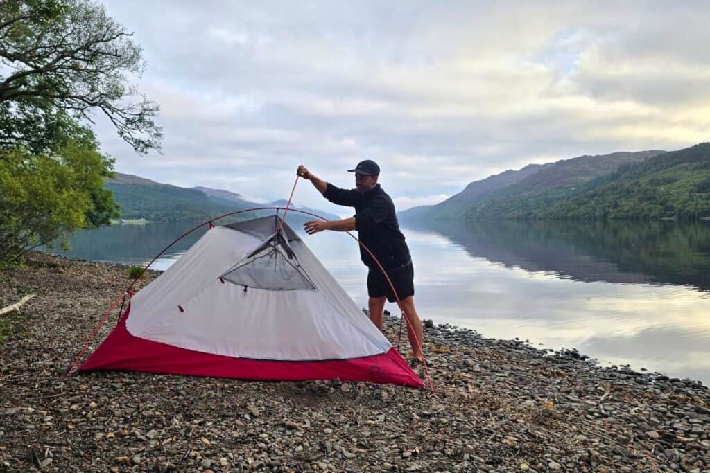
Wild camping on the loch shores is allowed under the Scottish Outdoor Access Code (more on that below). We wild camped at Fort Augustus and on Loch Ness. We had a fire most nights, using the existing fire pits where we could, or keeping it small on the beach near the water, well away from any trees or vegetation.

The Scottish Outdoor Access Code
Scotland has some of the best access rights in Europe. Under the Land Reform (Scotland) Act 2003, walkers, canoeists and other non-motorised users have a legal right to access most land and inland water, and that includes wild camping. It’s what makes a trip like the Great Glen possible.
Those rights come with responsibilities, set out in the Scottish Outdoor Access Code. It’s built on three principles:
- Respect the interests of other people
- Care for the environment
- Take responsibility for your own actions
For paddlers on the Great Glen, that means:
- Camp lightly: small groups, lightweight tents, and no more than two or three nights in one spot
- Leave no trace: take all your rubbish with you and leave each site as you found it, or better
- Toilets: use the composting toilets at the Trailblazer Rests where you can. Otherwise, bury waste at least 30m from lochs and burns
- Fires: the Code recommends using a stove. If you do have a fire, use an existing fire pit where there is one, keep it small, and never light one near trees or vegetation
- Respect the rules on canal land: use marked pitches at the informal canal-side sites, and don’t camp on the canal banks themselves
Access rights work because most people use them responsibly. Leave the trail as good as you found it for the next group.

Paddling Loch Ness: Is It Dangerous?
Loch Ness isn’t dangerous if you respect it, but it’s the part of the trail that catches people out. It caught us out too. None of us expected the waves to be so big, and even in very light winds, it was hard work.
The loch is long, straight and lined with hills, so the wind funnels down it and builds waves over the full 32km (20 miles). The water is cold enough all year that a capsize in the middle is serious.
What I’d recommend:
- Check the forecast every day, and be ready to sit out a day if the wind is strong
- Paddle the south shore, and stay close enough to the shore to land quickly
- Wear your buoyancy aid at all times
- Strap all your gear into the canoe
- Keep the group together, especially on crossings
- In an emergency on the water, call 999 and ask for the Coastguard
Boat traffic wasn’t a big problem for us. We saw a few larger cruisers, but they generally kept well away, and most of the bigger boats now have catamaran-style hulls that throw out a much smaller wake.
Speedboats are a different story. On Loch Ness, a speedboat passed on the far side of the loch, and by the time its wake reached us, the waves were surprisingly large. We were heading straight into them and were fine. A little further on, we found three other canoes that had all been capsized by the same wake. Thankfully everyone was OK, but they lost some gear.
Turn your bow into a wake rather than letting it hit you side-on, and strap everything down in your canoe, so a capsize doesn’t cost you your kit.
Food, Water and Midges
Food: We carried all our own food in the barrels. Most of the group took ration-style meal packs, and I used Wayfayrer meals. For snacks on the water, we lived on nuts, dark chocolate and dried fruit. Fort Augustus is the main place to stock up or grab a meal, and that’s where we treated ourselves to fish and chips.
Water: We started with one large container shared between the six of us, plus our own bottles. After that, we filtered water from the lochs and bought more in Fort Augustus. A good filter saves a lot of carrying – I’ve rounded up my favourites in my guide to the best water filters for hiking.
Midges: They weren’t nearly as bad as I’d expected. We all used Smidge and kept our arms and legs covered in the mornings and evenings, which was enough. We were lucky, though. The Highland midge season runs from late May to early September and peaks in July and August, so we were towards the tail end of it. Midges are worst at dawn and dusk, and on still, damp, overcast days. A breeze keeps them away, so camp somewhere open to the wind if you can, and pack a head net if you’re paddling in early or midsummer.
Wildlife on the Great Glen
Don’t expect a wildlife safari. We didn’t see a great deal, and Nessie didn’t make an appearance. The highlight of our trip was an osprey nest near Foyers, with a couple of birds circling low over the water as we paddled past. We also spotted small groups of wild goats chilling out on the beaches along Loch Ness, which was a nice surprise.
That said, the Great Glen is home to plenty of wildlife if you keep your eyes open, especially early in the morning and in the evening when it’s quieter on the water. Here’s what to look out for:
- Ospreys: watch for them diving into the lochs to catch fish
- Buzzards: often seen circling over the hillsides
- Grey herons: standing still in the shallows along the canal banks
- Mute swans and oystercatchers: common along the canal and loch shores
- Otters: shy and hard to spot, but they live along the waterway, so look out for ripples near the banks at dawn and dusk
- Red squirrels: around three-quarters of Britain’s red squirrels live in Scotland, and the woods along the Great Glen are a good place to see them
- Deer: red, roe and sika deer all live in the woodland along the route, and you’ll often spot them coming down to the shore early or late in the day
A small pair of binoculars in your deck bag is well worth the space.
What to Pack for the Great Glen Canoe Trail
Your hire company should provide the canoe, paddles, buoyancy aids, and a dry barrel. Beyond that, you’ll need a full camping setup, cooking kit, warm and waterproof layers, and a way to keep everything dry.
I’ve written up everything I took, what worked, and what I’d leave behind in my Great Glen Canoe Trail kit list.
Tips for Paddling the Great Glen Canoe Trail
These are the lessons our group learned along the way, and what I’d recommend to anyone planning the trip.
- Pack light. Adam and I packed light, and our canoe sat high in the water and handled the waves well. The rest of the group overpacked, and their canoes sat low, took on water and were much harder to control on Loch Ness.
- Cross the ends of the lochs diagonally. Hugging the shore and then cutting straight across puts the waves side-on, which is how some of our group ended up bailing out at the end of Loch Lochy. A diagonal line keeps the waves behind you.
- Make sure the whole group knows what they’re signing up for. Without a current to help, it’s hours of steady paddling every day. If anyone in your group is less experienced, get a couple of practice days on open water in beforehand.
- Build in a spare day. A gale warning turned our five-day trip into a four-day rush. With a spare day, you can sit out bad weather instead of racing it.
- Get organised for portages. The difference between a 10-minute portage and a 45-minute one is mostly organisation: pack so the heavy kit comes out fast, and agree who carries what.
- Take Loch Ness seriously, even on a calm day. Ours went from a millpond to 80cm waves in a few hours.
Final Thoughts
The Great Glen Canoe Trail is one of the best multi-day paddles in the UK. It takes you coast to coast across the Highlands, past castles, through Telford’s locks and down the full length of Loch Ness, and you camp on beaches most people only see from the road.
It’s also harder than it looks on a map. Go with some open-water experience, a flexible plan, and a group that knows what to expect, and it’s a trip you’ll talk about for years to come.
Related Guides & Reviews
The resources below cover the basics, common questions, and related kit to help you get more out of your time outdoors.
- Multi-Day Canoe Kit List For the Great Glen Canoe Trail
- Wave Kayaks and Canoe: The Full Range Compared

Steve Cleverdon
Adventure-driven outdoor gear reviewer and paddleboarder, Steve has spent 20 years exploring rivers, coastlines, and trails across Britain and abroad, sharing what he’s learned along the way. Learn more about Steve or get in touch.